On this page
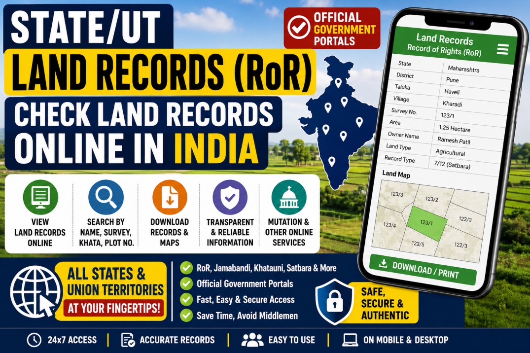
Land records in India are maintained by the respective state and Union Territory revenue authorities.
Depending on the location, a land record may be known as:
- Record of Rights
- RoR
- Jamabandi
- Khata
- Khatauni
- Khasra
- Pahani
- RTC
- Bhulekh
- Satbara or 7/12
- Patta and Chitta
- Fard
- Adangal
Most states and Union Territories now provide at least some land-record information through official online portals.
Citizens may be able to search using details such as the district, tehsil, taluka, village, survey number, plot number, khata number, owner’s name, or another locally used identifier.
Important: Nuvelloza.com is an independent informational website. We do not maintain land records, certify ownership, correct records, or represent any government department. Always use the official state or Union Territory portal.
Land Records Online: Overview
| Particular | Details |
|---|---|
| Record type | Record of Rights and related land records |
| Responsible authority | State or Union Territory revenue department |
| Central programme | Digital India Land Records Modernization Programme |
| Common search details | District, tehsil, village, survey number, plot number, or owner name |
| Online viewing | Available in most states and Union Territories |
| Digitally signed copy | Available only where the state provides the facility |
| Mutation service | Online in selected states |
| Land maps | Available through selected cadastral-map portals |
| Legal validity | Depends on state law and document type |
What Is a Record of Rights?
A Record of Rights is a revenue record containing information about a land parcel and the persons whose names or interests are recorded against it.
Depending on the state, it may contain:
- Recorded holder or occupant’s name
- Survey, plot, khasra, or khata number
- Land area
- Land classification
- Cultivation details
- Revenue assessment
- Mutation entries
- Tenancy-related information
- Rights and liabilities
- Mortgage or charge entries
- Other state-specific information
The format and legal effect of the record vary from state to state.
Is an Online Land Record Proof of Ownership?
An online RoR is an important land-revenue record, but it should not automatically be treated as conclusive proof of legal title.
Before purchasing, selling, mortgaging, or inheriting property, users may also need to verify:
- Registered sale deed
- Chain of title
- Mutation history
- Encumbrance information
- Cadastral or survey map
- Court orders
- Inheritance records
- Property-tax records
- Registration-office records
- Applicable land-use restrictions
A plain online display, screenshot, or unsigned printout may be intended only for information.
Where the state provides a digitally signed and legally valid RoR, download that version for official use. The Government reported that citizens in 19 states could download digitally signed, legally valid land records from home as of late 2025, but availability still varies by jurisdiction.
Digital India Land Records Modernization Programme
The earlier National Land Records Modernization Programme was approved in 2008.
It was subsequently revamped as the Digital India Land Records Modernization Programme, or DILRMP, as a Central Sector Scheme with full Central Government funding from April 1, 2016.
The programme aims to modernise land-record management, improve transparency, reduce the scope for disputes, and support better coordination between textual records, cadastral maps, registration systems, mutation processes, and revenue administration.
The official DILRMP dashboard tracks matters such as:
- Computerisation of Records of Rights
- Digitisation of cadastral maps
- Survey and resurvey progress
- Online revenue courts
- Online mutation facilities
- Digitally signed RoRs
- Integration between land and registration systems
The national dashboard reported more than 99% computerisation of available Records of Rights, although map digitisation, survey, mutation, and legal-validity facilities remain at different stages across states.
Main Benefits of Digitised Land Records
Easier Public Access
Citizens may check available land information without repeatedly visiting a revenue office.
Greater Transparency
Online access can help people review the names, numbers, areas, and entries currently recorded against a parcel.
Faster Error Identification
A landholder may identify spelling mistakes, missing mutation entries, or inconsistencies and approach the responsible authority for correction.
Support for Loans and Schemes
Banks and government authorities may request land records when processing agricultural loans, compensation claims, subsidies, or other applications.
The authority decides whether it requires an informational copy, a certified copy, or a digitally signed record.
Access to Maps
Some states provide cadastral maps, field measurement books, or GIS-based land information alongside textual records.
A map displayed online should not be treated as a substitute for an official boundary survey.
Online Mutation Services
Selected states allow citizens to submit or monitor mutation applications online.
Mutation means updating the revenue record following events such as:
- Sale
- Gift
- Inheritance
- Partition
- Court order
- Government acquisition
Mutation does not itself create a lawful title when the underlying transaction or claim is invalid.
How to Find Your State’s Official Land-Record Portal
The safest starting point is the Government of India’s DILRMP State/UT RoR directory.
The Department of Land Resources maintains a State/UT Record of Rights availability page showing jurisdictions where RoRs are accessible online.
Users should:
- Open the official DILRMP land-record directory.
- Select the relevant state or Union Territory.
- Follow the listed government land-record service.
- Confirm that the destination is an official government website.
- Search using the required local land details.
Do not rely solely on old blog posts because portal names and addresses may change.
How to Check Land Records Online
Although every state has a different portal, the general process is similar.
Step 1: Open the Official Portal
Open the official Revenue, Bhulekh, Bhoomi, Jamabandi, or land-record portal for your state.
Check that the website is operated by a government department.
Step 2: Select the Record Type
Choose the relevant service, such as:
- Record of Rights
- Jamabandi
- Khatauni
- Khasra
- RTC or Pahani
- 7/12
- Patta or Chitta
- Property Card
- Land map
Step 3: Select the Location
Enter or choose:
- District
- Subdivision
- Tehsil or taluka
- Block
- Village
- Ward, where applicable
Step 4: Choose the Search Method
The portal may allow searching through:
- Survey number
- Plot number
- Khasra number
- Khata number
- Patta number
- Dag number
- Owner or tenant name
- Unique land-parcel number
Searching by an official parcel number is usually more precise than using only a name.
Step 5: Complete the Captcha or Verification
Enter the captcha, mobile number, OTP, or another detail requested by the official portal.
Never share an OTP with an agent.
Step 6: Review the Record
Check:
- Recorded name
- Parcel number
- Area
- Village
- Land type
- Mutation entries
- Other displayed details
A similar name does not prove that the record belongs to the person you are searching for.
Step 7: Save or Download
Depending on the state, you may be able to:
- View the record
- Print an informational copy
- Save a PDF
- Apply for a certified copy
- Download a digitally signed document
- Verify a signed document
Fees may apply for certified or digitally signed copies.
Examples of Official State Land-Record Services
The following are examples of commonly used official services. Portal addresses and service names can change, so users should confirm them through the state government or DILRMP directory.
Andhra Pradesh
The MeeBhoomi service provides access to available Andhra Pradesh land-record information. An official Andhra Pradesh district page describes MeeBhoomi as the state portal for viewing digitised land records.
Karnataka
Karnataka’s Bhoomi platform provides RTC or Pahani-related land-record services.
Maharashtra
Maharashtra uses Mahabhulekh for viewing records such as 7/12 and provides separate facilities for digitally signed land records.
Telangana
Telangana currently provides land-detail searches through the official Bhu Bharati portal. The portal displays updated land-record details and identifies itself as a service of the Chief Commissioner of Land Administration.
West Bengal
West Bengal uses the official Banglarbhumi land and land-reforms portal.
Goa
Goa provides Record of Rights and property or land information through official Goa Online and land-record services. The Goa Online service notes that available digitised records can be accessed without a physical departmental visit.
For all other jurisdictions, use the central State/UT RoR directory instead of guessing the portal address.
State and UT Land-Record Directory
Readers may search for the following state or Union Territory through the official DILRMP directory:
- Andhra Pradesh
- Arunachal Pradesh
- Assam
- Bihar
- Chhattisgarh
- Goa
- Gujarat
- Haryana
- Himachal Pradesh
- Jharkhand
- Karnataka
- Kerala
- Madhya Pradesh
- Maharashtra
- Manipur
- Meghalaya
- Mizoram
- Nagaland
- Odisha
- Punjab
- Rajasthan
- Sikkim
- Tamil Nadu
- Telangana
- Tripura
- Uttar Pradesh
- Uttarakhand
- West Bengal
- Andaman and Nicobar Islands
- Chandigarh
- Dadra and Nagar Haveli and Daman and Diu
- Delhi
- Jammu and Kashmir
- Ladakh
- Lakshadweep
- Puducherry
The availability of online RoRs, maps, mutations, signed downloads, urban-property records, and legal-validity features differs across jurisdictions.
Common Land-Record Names by State
Users may encounter terms such as:
| Common term | Meaning or usage |
|---|---|
| RoR | Record of Rights |
| Bhulekh | General term used for land-record services |
| Jamabandi | Rights and cultivation record used in several northern states |
| Khasra | Parcel or field-related record number |
| Khatauni | Holding or cultivator-related record |
| Khata | Landholding account |
| RTC or Pahani | Record of Tenancy and Crops |
| 7/12 or Satbara | Maharashtra rural land record |
| Patta | Record or assignment connected with landholding |
| Chitta | Tamil Nadu land-revenue record |
| Dag number | Plot identifier used in some eastern and northeastern states |
| Fard | Copy or extract of a land record |
The same word may have different administrative meaning in different states.
Digitally Signed vs Informational Copies
Informational Copy
An ordinary online display may be used to:
- Check basic details
- Confirm the available entry
- Find the parcel number
- Identify possible errors
- Conduct preliminary research
It may not be accepted for official work.
Digitally Signed or Certified Copy
A digitally signed or officially certified copy may be required for:
- Bank loans
- Court proceedings
- Government applications
- Property registration
- Mutation
- Compensation claims
- Legal verification
Whether a digitally signed document is legally valid depends on the applicable state’s system and law. The DILRMP dashboard separately tracks whether signed RoRs are downloadable and legally valid in each state.
How to Correct an Error
If a record contains incorrect information:
- Do not edit or alter the downloaded document yourself.
- Check whether the state offers an online correction or mutation service.
- Collect supporting documents.
- Submit the request to the relevant revenue authority.
- Save the acknowledgement number.
- Attend verification or a hearing when required.
- Check the updated record after approval.
Supporting documents may include:
- Registered deed
- Identity proof
- Mutation order
- Inheritance certificate
- Partition deed
- Court order
- Survey document
- Tax receipt
- Other evidence requested by the authority
Submitting a request does not guarantee approval.
Common Problems
Record Not Found
Possible reasons include:
- Incorrect village selected
- Wrong survey or plot number
- Different spelling of the owner’s name
- Record not yet digitised
- Recent mutation still pending
- Urban property searched on a rural portal
- Changed parcel number
- Portal maintenance
Name Is Incorrect
A wrong name may result from:
- Old records
- Pending inheritance mutation
- Spelling variation
- Data-entry mistake
- Unregistered transfer
- Unresolved dispute
Contact the responsible revenue authority.
Map Does Not Match the Ground
Online cadastral maps may not reflect a recent subdivision or physical boundary dispute.
A licensed survey or official demarcation may be necessary.
Portal Is Not Opening
Government portals can experience:
- Maintenance
- High traffic
- Browser issues
- Server downtime
- Security-certificate changes
Access the service through the official state website or central DILRMP directory.
Important Safety Tips
- Use official government websites only.
- Do not share Aadhaar OTPs.
- Never send fees to a personal bank or UPI account.
- Verify the parcel number, not only the owner’s name.
- Do not publish private land records publicly.
- Keep the original digitally signed PDF.
- Check whether the copy is legally valid.
- Verify the registered sale deed before buying land.
- Obtain legal due diligence for property transactions.
- Use official mutation and correction procedures.
- Be cautious of agents promising instant ownership changes.
Frequently Asked Questions
Is there one national portal containing all Indian land records?
There is a central DILRMP directory and monitoring system, but land records are accessed through state- and Union Territory-specific services.
Can I search land records by name?
Many portals offer name-based searches, but availability differs. Survey, plot, khata, or khasra numbers are usually more reliable.
Can I download land records free?
Viewing may be free on many portals. Certified or digitally signed copies may require a fee.
Is an online record legally valid?
A plain online display may not be legally valid. Check whether the state provides a digitally signed or certified copy.
Can I buy property based only on the RoR?
No. Verify the registered title, encumbrances, mutation history, maps, restrictions, and other relevant documents.
Can mutation be completed online?
Selected states provide online mutation submission or status tracking. Availability and final verification vary.
What is a cadastral map?
It is a map showing land parcels, survey boundaries, and related geographic details. It does not always settle an active boundary dispute.
What should I do if my state portal has changed?
Use the official DILRMP State/UT RoR directory or the state Revenue Department website to find the current service.
Final Words
DILRMP and state-level land-record portals have made land information easier to access across India.
Citizens can use these services to:
- Review available Records of Rights
- Check parcel details
- View maps where available
- Monitor mutations
- Download authorised copies
- Identify possible record errors
However, online land records should be used carefully.
For property purchases, inheritance, mortgages, disputes, or legal proceedings, verify the record through the responsible authority and obtain qualified legal advice.
Disclaimer
This article is provided for general informational purposes only.
Nuvelloza.com does not maintain land records, issue certified copies, verify property titles, conduct surveys, process mutations, or represent the Department of Land Resources or any state government.
Portal addresses, services, fees, records, and legal-validity rules may change.
Users must verify current information through the official Department of Land Resources, DILRMP directory, state Revenue Department, Sub-Registrar, Tehsildar, Talathi, Patwari, or another competent authority.
For property purchases, ownership disputes, succession, or title verification, consult a qualified legal professional.

nuvelloza
Nuvelloza’s editorial team is responsible for researching, reviewing, and maintaining this guide.
More articles by this authorRelated guides
Live Rain Tracker App: Download RainViewer on Android and iPhone
On this pageRainViewer App OverviewWhat Is RainViewer?Main Features of RainViewerLive Rain RadarShort-Term Rain ForecastRain and Weather AlertsLocal Weather ForecastsRainfall TotalsTropical Storm and Hurricane…

How to Apply for a Driving Licence Online in India: Learner’s Licence, Test and Download Process
On this pageDriving Licence Application OverviewWhat Is a Learner’s Licence?Eligibility by Vehicle TypeDocuments Commonly RequiredStep 1: Apply for a Learner’s Licence OnlineOpen the…

Voter List 2026: Check Your Name and Download the Electoral Roll Online
On this pageVoter List 2026 OverviewWhat Is a Voter List?Why Is the Electoral Roll Important?Confirms Voting EligibilityShows Polling DetailsHelps Detect ErrorsReduces Last-Minute ProblemsIs…